SolSpec Solutions Has Engineered Cutting Edge Aerial Imaging and Data Analytics Software for the Oil & Gas Industry
Colorado-based company SolSpec has announced that they now have completed a company milestone in providing aerial imaging services and data analytics for over 3000 miles of oil and gas pipeline right-of-way.
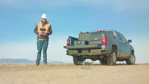
Golden, Colorado-based company SolSpec has reached a company milestone in their oil & gas aerial imaging services. The company specializes in insightful data analytics for the oil & gas industry by translating aerial imaging photography into actionable results.
More information can be found here: https://www.solspec.solutions
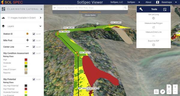
The company provides aerial imaging services for unlimited lengths of right-of-way, including aerial data analytics and actionable results, with maps loaded into a viewer similar to Google Earth.
Aerial imaging helps predict and minimize slips, as well as provide data that aids in faster re-vegetation of pipeline rights-of-way. The provided reports save their clients 20% to 80% of their costs by identifying and preventing issues before they happen.
SolSpec utilizes proprietary aerial imagery analytics as well as state of the art visualization software called SolSpec Viewer. The viewer is a powerful tool that allows clients to inspect an entire right-of-way in one platform and zoom in to see current aerial imagery on any portion of the project.
The SolSpec Viewer software was specifically designed for the oil & gas industry but is also very effective in other industries such as mining, utilities, and civil construction. The analytics program will eventually grow to serve these other industries as well.
The SolSpec Analytics and Viewer software are cloud-based and run on powerful servers designed to handle the largest projects. SolSpec is the leading aerial imagery company for the oil and gas industry providing not only drone mapping visualization but cutting-edge data analytics as well.
SolSpec has provided aerial imaging and data analytics to top-tier companies such as Dominion Energy, Noble Energy, Energy Transfer Partners, Mark West, Antero Midstream GP, Suncor, PDC Energy, Whiting, and more.
The company is focused on quickly solving complex problems for the energy industry, and aim to stay ahead by utilizing the newest technologies to consistently offer the best possible aerial imaging and data analytics to their clients. Interested parties can find more information at the link above.


